REVIEW · HANKSVILLE UTAH
Hanksville/Torrey: Bentonite Hills Drone/Photography Tour
Book on GetYourGuide →Operated by Meridian Photography tours and more · Bookable on GetYourGuide
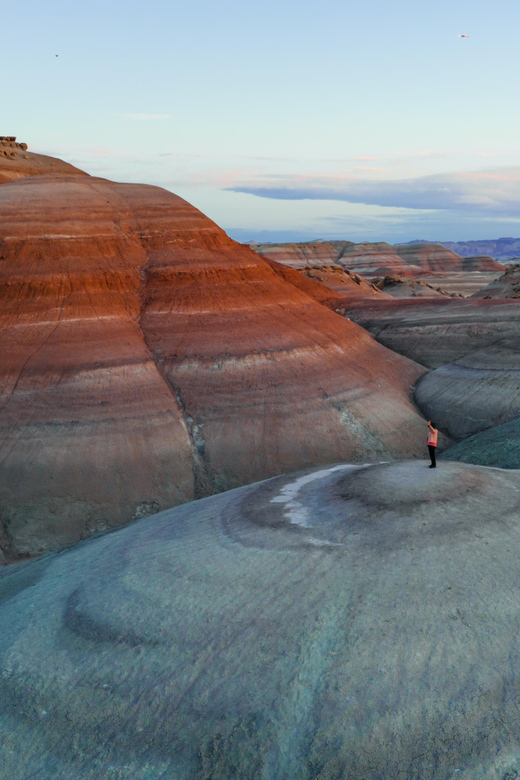
Mars-like red terrain starts in Hanksville. I love the Bentonite Hills feel, like you’re standing on another planet near the NASA Mars research facility, and I love that the tour is built for photography—not just driving around.
The trade-off is effort. The best viewpoints need a climb of about 50 to 100 feet, so low fitness or mobility limits can be a deal-breaker. Past groups have raved about Jenny for steering you to the right bentonite patterns, with Mel also sharing helpful local direction.
In This Review
- Key highlights that make this tour worth it
- Why Utah’s Bentonite Hills near NASA look like Mars
- Getting picked up the Meridian way (and why it matters)
- The 3-hour off-road photo experience near the Martian-like ridges
- The climb factor: 50 to 100 feet for the strongest views
- Still photos, aerial extras, and the drone question
- Price and value: is $180 a fair deal for this kind of tour?
- Who this tour suits best (and who should skip it)
- Languages, guide style, and what earlier groups say you’ll get
- Quick practical checklist before you go
- Should you book the Hanksville/Torrey Bentonite Hills Drone/Photography Tour?
- FAQ
- How long is the Bentonite Hills drone/photography tour?
- Where does pickup happen?
- Is this a private tour?
- What languages are offered during the tour?
- Is water provided?
- Is drone video included in the price?
- Can I rent a drone for this tour?
- What should I bring?
- Is the tour refundable if I change my plans?
- What happens if weather is bad?
Key highlights that make this tour worth it
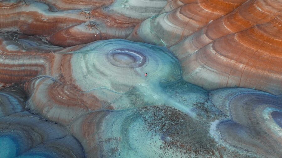
- Martian-like views near the NASA Mars research facility that feel wildly different from anywhere else in Utah
- Private, guided off-road photography where you get help finding strong angles and compositions
- Hidden bentonite spots guided by instructors who focus on both scenery and how to see it
- 50 to 100 feet of climbing to reach the views with the strongest patterns and color contrasts
- Optional drone video add-on if you want aerial footage beyond still photos
Why Utah’s Bentonite Hills near NASA look like Mars
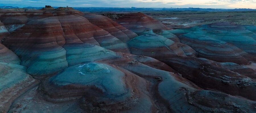
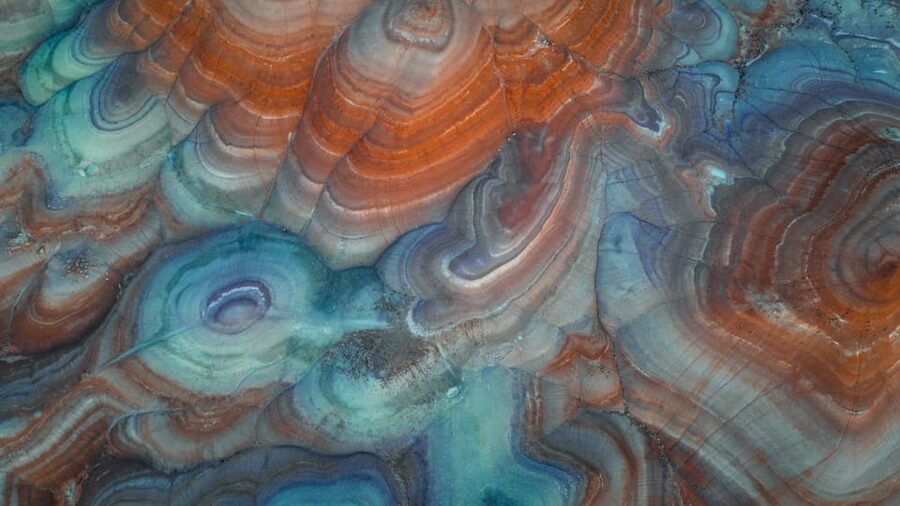
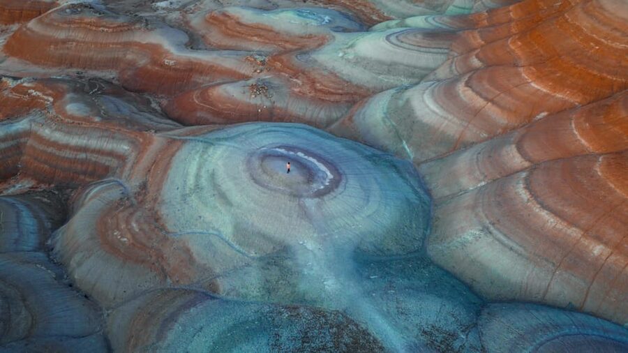
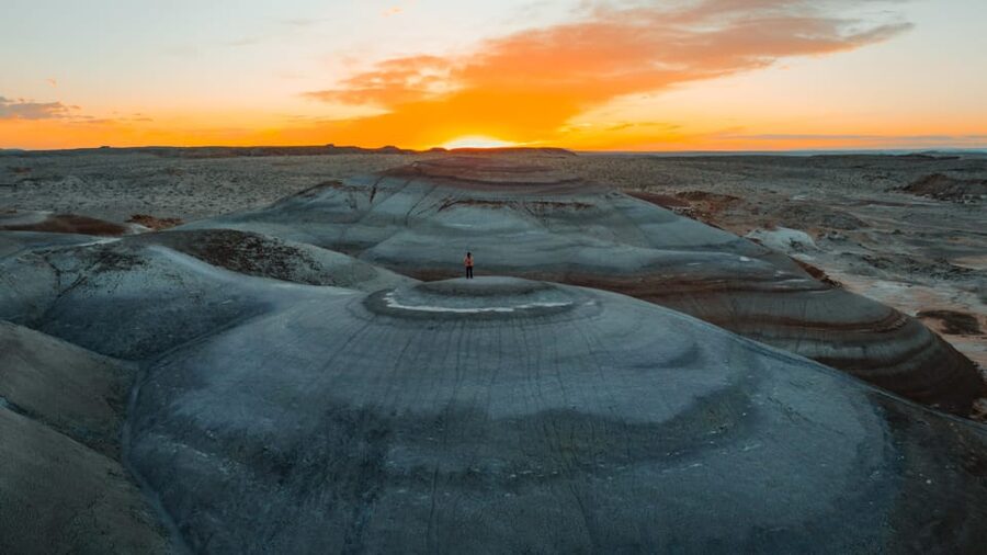
You come to Hanksville for the red-and-iron desert vibe. But what makes this area so photo-friendly is how the Bentonite Hills create weird, alien textures. Up close, the ground reads like layered matter. From the right angles, it looks like a planet surface—especially with the NASA Mars research facility nearby, which gives the whole outing a real sense of exploration.
I like that the tour doesn’t treat this like a quick drive-by stop. It’s actually a seeing exercise. You’re learning how to frame the terrain so the patterns do the heavy lifting. Even if you’re not a “serious photographer,” the guided approach helps you avoid the common mistake: pointing the camera at something impressive, then realizing your best view was two steps off to the side.
The other big win is the tone. This feels like a guided photo walk with an exploration mindset. When Jenny (a guide mentioned by earlier groups) leads you toward the right bentonite areas, it turns the scenery into something you can interpret, not just record.
Getting picked up the Meridian way (and why it matters)
This is a private group tour, and that’s a big deal for a place like this. Off-road terrain changes fast. Being with a guide who controls the route means you’re more likely to hit the best photo areas without wasting time figuring things out on your own.
Pickup is included. You’ll want to watch for a Black or White SUV with MERIDIAN letters on it. The tour also offers complimentary pickup from Hanksville, Torrey, and Teasdale, so you’re not forced into an awkward “get yourself there” situation.
Time-wise, the outing is 3 hours. That’s long enough to drive in, reach a few strong vantage points, and shoot with breathing room, but short enough that you don’t feel trapped all day in remote terrain. If your Utah itinerary is already packed with scenic stops, this kind of duration is exactly what you want.
The 3-hour off-road photo experience near the Martian-like ridges
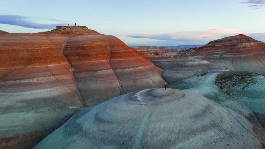
The core idea is simple: you go off-road into the Bentonite Hills around the NASA Mars research area, then you pause often—long enough to shoot, adjust, and try again from new positions.
You should expect:
- Off-road travel over rocky trails and uneven ground
- Guided stops at vantage points designed for “wow” factor patterns
- Photo coaching focused on finding angles that make the terrain look surreal
- A short learning component around the geology of the area, which is specifically called out by earlier participants
Even without a listed minute-by-minute schedule, the rhythm matters. Tours like this typically work in “hit a viewpoint, shoot, reposition, repeat.” That’s the best way to translate a dramatic location into usable photos. If you only get one shot from one spot, you’ll miss the terrain’s layered look.
The best part is that you’re not just out there clicking away. The guiding is what turns the trip into a skill-building session. Earlier groups highlighted Jenny’s knowledge and passion, especially when it comes to guiding people to spots that feel hidden once you’re standing in the general area.
The climb factor: 50 to 100 feet for the strongest views
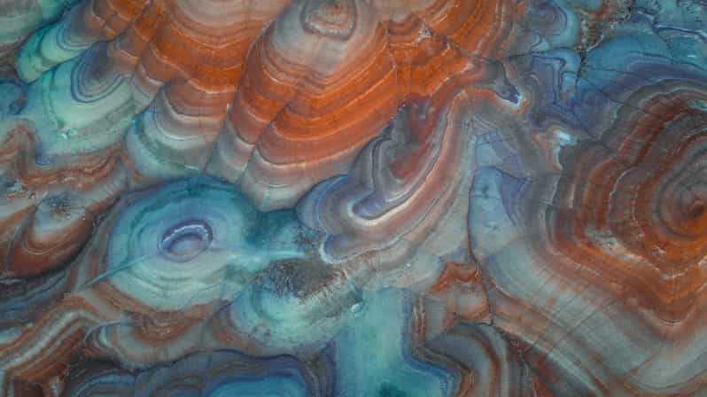
Here’s the practical reality check. To fully appreciate the unique patterns and vibrant colors of the Blue Bentonite Hills, you’ll need to climb about 50 to 100 feet to reach the best vantage points.
That’s not a “nice to have.” It’s the difference between decent and excellent photos. From higher points, the terrain’s texture reads more clearly, and the layered look becomes easier to capture.
So think about your body first:
- This tour is ideal if you can handle uneven ground and a short climb
- It’s not suitable for people with low level fitness
- It’s not suitable for mobility impairments
If you’re unsure, be honest about your walking limits. I’d rather you skip this and do something easier in the region than show up and spend the best light of your trip feeling stressed.
Still photos, aerial extras, and the drone question
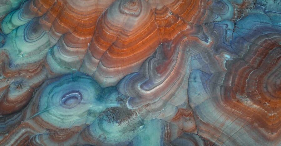
Photography is the main event here. The tour is guided with an emphasis on capturing surreal vistas, and you’ll come away with a better sense of how to work this kind of terrain.
You also have a drone option. Drone video footage is available as an add-on. The standard tour itself doesn’t include drone output, and you can rent a DJI Mini 4 if you want to include drone work.
A practical way to plan: decide early if drone footage matters for you. Aerial views are great for showing scale and patterning, but adding it can shift how you think about your priorities during the 3 hours. If you want both stills and drone, I’d schedule your expectations around learning time and shooting time rather than treating it like a quick grab.
If you’re bringing your own gear, you’ll still want to follow the tour’s practical constraints: closed-toe shoes, readiness for uneven ground, and moving when the guide tells you to.
Price and value: is $180 a fair deal for this kind of tour?
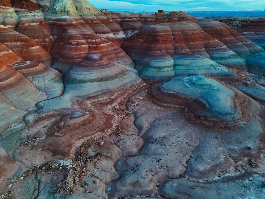
At $180 per person, this isn’t a throwaway “just a scenic drive” excursion. You’re paying for:
- Transportation and pickup/drop-off
- A guide who knows where to take you for strong photo results
- Water
- Access to a private outing format
- A tour built specifically for drone photography interest (with an optional add-on)
In remote places like these, the big hidden cost is always time and know-how. A self-drive trip can be fun, but you’ll likely spend extra time searching for angles and end up with fewer “keepers.” Here, the value is that you’re guided to the right bentonite spots and you get context that helps your photos read better.
The also-important part: the group format. A private group means the guide can keep the outing moving at a pace that supports photo stops rather than herding a crowd.
If you’re mainly interested in a relaxed look around, you might not get full value. But if your goal is photographs that actually capture the area’s alien feel, the pricing makes sense.
Who this tour suits best (and who should skip it)
This is a very specific match:
- Great fit for people interested in drone photography
- Great fit for photo enthusiasts who want guidance, not just scenery
- Best fit if you can handle a 50 to 100 feet climb and walk on rocky terrain
- Good fit if you want a guided geology-focused perspective alongside your camera time
It’s not suitable for:
- People with mobility impairments
- People over 60 years
- People with low level of fitness
If you fall into one of those categories, I’d skip it and choose a more comfortable option in the region. The views are worth it, but the physical demands aren’t flexible.
Languages, guide style, and what earlier groups say you’ll get
The tour runs with an English-speaking guide, with Russian and Italian also offered. If you want a session with clear guidance rather than vague directions, this multilingual setup helps you feel comfortable asking questions and getting what you need for better photos.
Names that came up include Jenny and Mel. Earlier groups specifically credited Jenny with guiding them to bentonite areas and doing it with knowledge and passion. Mel was also mentioned for providing direction and recommendations for other things to do nearby—useful if you want to turn one day into a whole itinerary instead of just one activity.
Even if your photography level is basic, a guide who knows the terrain can help you avoid the “I saw it, but my photos don’t look like what I saw” problem.
Quick practical checklist before you go
You’ll want:
- Closed-toe shoes (this is required)
- Basic comfort for rocky, uneven travel
- A willingness to climb to viewpoints when the guide says it’s time
Water is included, which is a nice touch in Utah’s desert conditions. Also note that weather and terrain are unpredictable here. The tour may be modified, rescheduled, or even canceled in the worst case.
Should you book the Hanksville/Torrey Bentonite Hills Drone/Photography Tour?
Book it if you want a focused Utah photography tour with guided off-road access to Martian-like Bentonite Hills near the NASA Mars research facility, and you’re excited about getting the strong angles that require a real climb.
Skip it if you’re looking for an easy stroll, have mobility limitations, or you’re not comfortable with the 50 to 100 feet of climbing to reach the best vantage points. In this part of Utah, the photos improve when you do.
If you do book, your best move is to align your expectations: this is a photo-first outing. Let the guide control the route and stops, and use the time to shoot, reposition, and try again.
FAQ
How long is the Bentonite Hills drone/photography tour?
The tour lasts 3 hours.
Where does pickup happen?
Complimentary pickup is available from Hanksville, Torrey, and Teasdale. You should look for a Black or White SUV with MERIDIAN letters.
Is this a private tour?
Yes. It’s listed as a private group.
What languages are offered during the tour?
The live guide is available in English, Russian, and Italian.
Is water provided?
Yes. Water is included.
Is drone video included in the price?
Drone video footage is not included in the base tour price. It’s available as an add-on.
Can I rent a drone for this tour?
A DJI Mini 4 is available to rent.
What should I bring?
Bring closed-toe shoes.
Is the tour refundable if I change my plans?
Yes. It offers free cancellation up to 24 hours in advance for a full refund.
What happens if weather is bad?
The tour may be modified, rescheduled, or canceled due to unpredictable weather and terrain. Weather as a reason for cancellation is determined by the provider, regardless of weather apps or park websites.