REVIEW · HANKSVILLE UTAH
Hanksville/Torrey: Bentonite Hills Drone/Photography Tour
Book on GetYourGuide →Operated by Meridian Photography tours and more · Bookable on GetYourGuide
Mars on Earth is three hours away. I love how the guided route turns the Blue Bentonite Hills near NASA’s Mars research facility into a real-world photo set, and I also love the focus on off-road vantage points and drone video footage options. It’s the kind of place where your camera suddenly feels too small for what you’re seeing.
Wear boots for real uneven ground. Reaching the best spots requires climbing about 50 to 100 feet on rocky terrain, so plan for some effort and don’t treat it like a flat sunset stroll.
In This Review
- Key Things I’d Bet You’ll Care About
- Why the Blue Bentonite Hills Feel Like Mars
- Getting There: Pickup from Hanksville, Torrey, Teasdale, and Highway 24
- The 3-Hour Off-Road Photo Session (What Happens in the Field)
- Photo Tips That Make These Hills Easier to Shoot
- The Guide Factor: Why Jenni’s Local Know-How Matters
- Drone Video Options: Add-On Footage and DJI Mini 4 Rental
- Accessibility and Fitness: The Part You Should Not Skip
- Price and Value: Is $200 per Person Worth It?
- Who This Tour Best Fits
- Should You Book This Hanksville/Torrey Drone/Photography Tour?
- FAQ
- Where does the tour take place?
- How long is the tour?
- What is the price per person?
- What’s included in the tour?
- How do I find the pickup vehicle?
- Where is pickup available?
- Are drones provided?
- What languages are the guides?
- Is this tour suitable for everyone?
- What’s the cancellation policy?
Key Things I’d Bet You’ll Care About
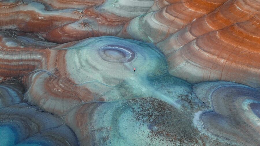
- Martian-like geology near NASA: red tones, strange patterns, and settings that look like another planet
- A guide who helps you make photos, not just take them: strong local know-how and shooting guidance
- Pickup from Hanksville, Torrey, Teasdale, and Highway 24: reduces driving stress in remote country
- Off-road access with controlled pacing: private format means the group stays together
- Drone options: DJI Mini 4 can be rented, and drone video footage is available as an add-on
- Comfort is about shoe choice: closed-toe shoes are not optional here
Why the Blue Bentonite Hills Feel Like Mars
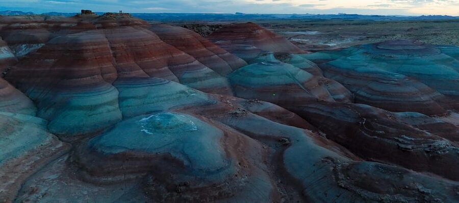
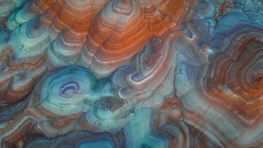
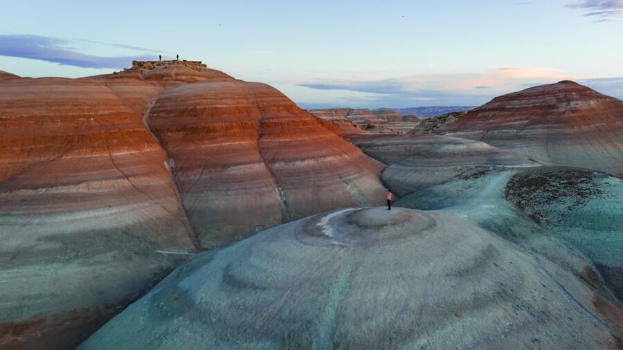
The Bentonite Hills around Hanksville can look alien fast. You get those dusty red tones and the kind of rock textures that seem designed for dramatic photos, not ordinary Earth walks. And being near NASA’s Mars research facility adds a fun layer of context: you’re photographing desert ground that’s tied to the same spirit of exploration that studies Mars.
What I like most is that the tour doesn’t treat the area like a static viewpoint you just look at from afar. It’s built around moving through the terrain to find angles. That means you’re more likely to come away with a variety of shots: wider desert views, tighter texture details, and compositions that show the scale.
You’ll also learn to slow down and notice the “patterns.” Bentonite formations create repeating lines and color shifts that are easy to miss if you’re rushing. With a guide steering the route, you can focus on seeing, not wandering.
The tradeoff is effort. You’re climbing to the better vantage points, and the terrain is uneven. If you show up thinking this is a casual outing, you’ll feel it.
Getting There: Pickup from Hanksville, Torrey, Teasdale, and Highway 24
Logistics matter more in places like this. You don’t want to be responsible for navigating remote roads while everyone else is already on their photo mission.
This tour includes pickup and drop-off, plus transportation. The friendly part: pickup is available from Hanksville, Torrey, Teasdale, and pretty much any location along Highway 24. So if you’re basing yourself in a common Utah town, it should be easy to plug in.
When you arrive, look for a Black or White SUV with MERIDIAN letters on it. That specific detail saves time and avoids the awkward moment of texting multiple people asking where the van is.
Because this is a private group, you’re not stuck with a crowd pace. The drive time and the stops feel more controlled. That’s useful for photography, since you need consistent timing for light and footing.
The 3-Hour Off-Road Photo Session (What Happens in the Field)
The tour lasts 3 hours, with starting times depending on availability. That’s a sweet spot. Long enough to get you to meaningful viewpoints and back, but short enough that the whole experience doesn’t drag.
Here’s the flow you can expect in practice:
First, you meet your guide and get set up with water (included) and a quick game plan. Then you head into the Bentonite Hills area near NASA’s Mars research facility. The route is off-road, and you’ll spend time on rocky trails designed for getting closer to the formations.
Next comes the photo work. The tour is explicitly a guided off-road photography experience, so the focus isn’t just walking. You’ll be navigating to vantage points that show off the rugged terrain and unique geological formations. If you’re new to photography, you’ll likely get help with how to frame what you’re seeing. If you already shoot, you’ll appreciate having local eyes to point you toward angles you might not think to search for.
Finally, you return toward your pickup point for drop-off. Because it’s a private group, you can typically expect a pace that matches your group’s energy level—though you should still be ready for the climb.
A key detail: the best viewpoints require climbing roughly 50 to 100 feet. That doesn’t mean you’ll be hiking all day, but it does mean you’ll be getting up over uneven ground. Bring your closed-toe shoes and treat the terrain with respect.
Photo Tips That Make These Hills Easier to Shoot
This tour is built for people who want better photos, not just a cool outing. Even if you bring a smartphone, you’ll benefit from thinking like a photographer for three hours.
I’d plan for three “photo modes” while you’re out there:
1) Wide desert shots
Use the big shapes. The terrain’s red tones and the sense of emptiness make for photos that feel cinematic even with simple framing.
2) Texture close-ups
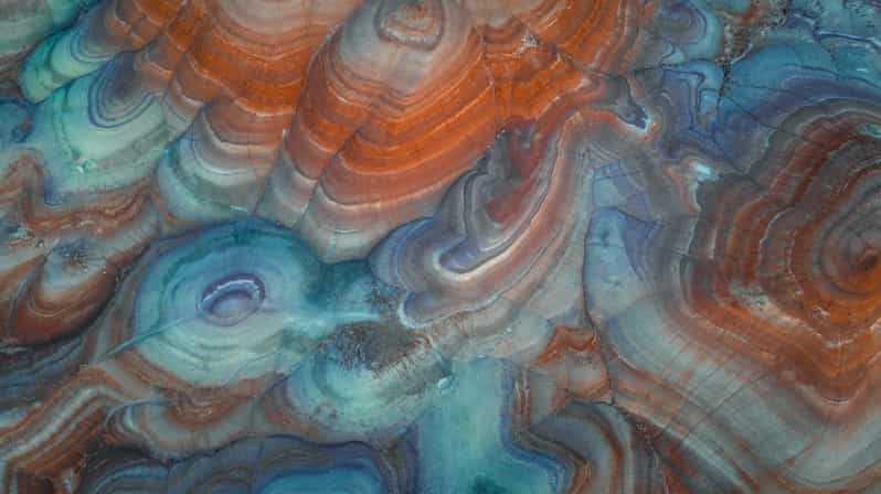
Bentonite patterns show up in cracks, lines, and layers. Get close where your camera can catch the details. These are the shots that tend to look the most unusual later.
3) Layered compositions
Try to include foreground rock plus mid-ground formations plus sky. That’s how you show scale and make the area feel truly otherworldly.
Because the guide leads you through the terrain, you don’t have to guess where the best angles are. And since the guides have extensive knowledge of the area (more on that next), you’re more likely to learn what to look for while you’re there, not after.
One more practical note: bring your patience. In a place like this, the light can change fast, and you’re moving on uneven ground. The tour format helps you stay efficient.
The Guide Factor: Why Jenni’s Local Know-How Matters
The reviews strongly emphasize the guide experience. One review specifically called out Jenni as a great guide, and the praise wasn’t vague. People highlighted her area knowledge and her ability to guide guests toward a better experience.
That matters because you’re not just walking in pretty scenery. You’re in a geology-heavy environment where small differences in vantage points can change everything in a photo. A guide who understands how the formations sit, where the patterns read best, and how to manage the terrain makes the trip feel smoother and more rewarding.
You’ll feel it in the way the tour is paced and explained. The goal is to help you capture the spirit of exploration and turn those Martian-like hills into real images you’re proud of.
Drone Video Options: Add-On Footage and DJI Mini 4 Rental
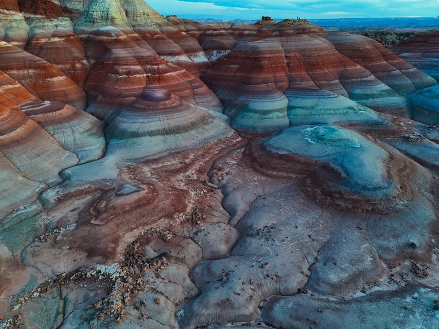
If you want that extra “this looks like Mars” feeling, the drone option is a big part of the pitch. Here’s what the tour data supports:
- Drone video footage is available as an add-on.
- A DJI Mini 4 is not included, but it can be rented.
So you have two paths. You can go with the add-on drone video footage, or you can rent the DJI Mini 4 if you want more control over how you shoot.
Either way, it’s worth thinking about your end product before you arrive. If you want polished video that matches the tour route, the add-on makes sense. If you’re building a drone clip library yourself, renting the drone could be the better fit.
Just remember the terrain requirement: even if the drone handles the aerial angles, you still need to reach vantage points on foot for the “ground truth” views.
Accessibility and Fitness: The Part You Should Not Skip
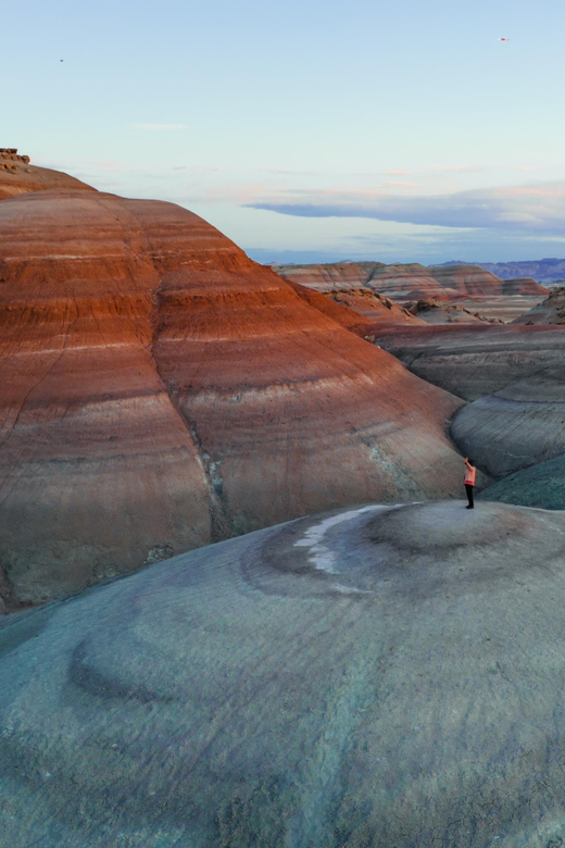
This tour is not for everyone. It’s marked as not suitable for people with mobility impairments, people over 60, and people with low level of fitness.
The most useful practical takeaway is the climb requirement: 50 to 100 feet. That’s enough vertical gain to make footing and stamina important, especially on rocky ground.
If you’re unsure, be honest with yourself about recent hikes. If you can’t do uneven terrain without fatigue, you may end up frustrated rather than inspired. For this specific area and format, “I can handle it” needs to include balance and leg endurance.
Price and Value: Is $200 per Person Worth It?
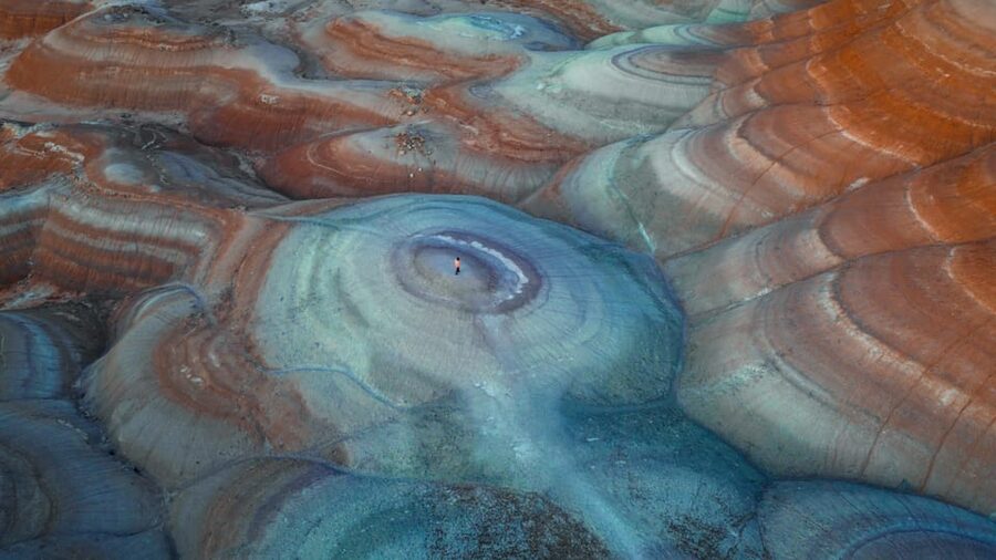
At $200 per person for a 3-hour private tour, you’re paying for more than just access to a scenic spot. You’re paying for:
- A guided experience in a remote area
- Transportation and included pickup/drop-off
- On-site support for photography
- Water
- Plus the optional drone video add-on path
Here’s the way I think about value in tours like this. The Bentonite Hills don’t come with built-in visitor infrastructure. So the real cost drivers are getting you there, getting you to the right vantage points, and helping you make better photos while you’re on the ground.
If you’re the type of traveler who wants to leave with stronger images, not just memories, this price can make sense. If you only want a quick glance from a car window, you’ll likely feel like you paid for effort you didn’t want.
The sweet spot is a person who enjoys photography and appreciates guides who know how to work the terrain and conditions.
Who This Tour Best Fits
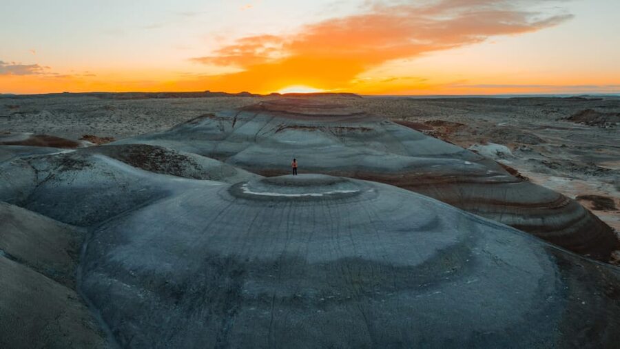
This is a strong match if you’re one of these:
- You love photography and want help getting angles and compositions in a place that rewards it
- You’re curious about the NASA Mars research connection and like exploration themes
- You want a photo-focused adventure with a guide, water, and vehicle support included
- You’re comfortable with short climbs and uneven ground
It’s less ideal if you need step-free access or you’re looking for an easy, low-effort outing.
Should You Book This Hanksville/Torrey Drone/Photography Tour?
Book it if you want photos that feel like a different planet and you’re okay with real desert terrain. The combination of guided off-road access, knowledgeable local guidance (including Jenni, per review praise), and drone video options makes this one of those tours that can change how you see and shoot a place.
Skip it if you want a purely relaxed sightseeing day. Between the climb to the best viewpoints and the off-road walking, this tour asks for basic fitness and solid footing.
If you’re in the middle—interested in the views, maybe even planning to shoot video too—this is exactly the kind of focused, time-efficient outing that can pay off fast.
FAQ
Where does the tour take place?
It’s in Utah around Hanksville, focusing on the Bentonite Hills near NASA’s Mars research facility.
How long is the tour?
The tour is 3 hours.
What is the price per person?
The price is $200 per person.
What’s included in the tour?
Pickup and drop-off, transportation, a guide, water, and drone video footage is available as an add-on.
How do I find the pickup vehicle?
Look for a black or white SUV with MERIDIAN letters on it.
Where is pickup available?
Pickup is available from Hanksville, Torrey, Teasdale, and any location along Highway 24.
Are drones provided?
A DJI Mini 4 is not included, but it’s available to rent. Drone video footage is also available as an add-on.
What languages are the guides?
The tour offers live guiding in English, Russian, and Italian.
Is this tour suitable for everyone?
It’s not suitable for people with mobility impairments, people over 60 years old, or people with low level of fitness. Closed-toe shoes are required.
What’s the cancellation policy?
You can cancel up to 24 hours in advance for a full refund.